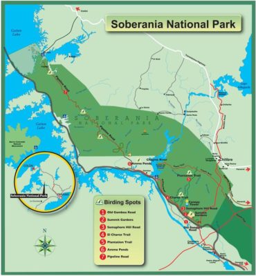
The Soberania National Park is located along the east bank of the Panama Canal and is part of its hydrographic basin. It occupies the provinces of Panama and Colón and is one of the most easily accessible protected areas in the country, located 25 kilometers from Panama City. With an area of 19,545 hectares, it was declared a protected area in 1980 by Executive Decree No. 13 of May 27.
General data
The Soberanía National Park has humid tropical forests and is located just 20 minutes from Panama City and 40 minutes from Colón. This park is the habitat of more than 1,300 species of plants and 525 species of birds. In addition, 105 species of mammals, 79 species of reptiles and 55 of amphibians, among others, have been identified.
The Soberania National Park is part of the biological corridor of protected areas in the eastern zone of the Panama Canal that also includes the Metropolitan Natural Park, the Camino de Cruces National Park and the Gatun Lake. The Soberania National Park is located along the east bank of the Panama Canal and is part of its hydrographic basin. It occupies the provinces of Panama and Colón and is one of the most easily accessible protected areas in the country, located just 25 kilometers from Panama City. With an area of 19,545 hectares, it was declared a protected area in 1980 by Executive Decree No. 13 of May 27.
History
The great diversity of flora and fauna in the park is complemented by the historical and cultural value represented by the conservation of the cobblestones of the Camino Real de Cruces, which crosses the East and West park, and the remains of the Venta de Cruces town. The first was used in colonial times to transport merchandise and treasures from Peru, Baja California and Chile. This was a communication route that linked the Atlantic with the Pacific, through a narrow path, but made of stones of different sizes, which were embedded in the earth, giving a solidity and firmness that defied the centuries. The Camino Real de Cruces presented enormous dangers, apart from the possibilities of attacks by criminals, robberies and murders, to which these desperate travelers were exposed. The events that happened in California, with the discovery of gold deposits, in California (1848), determined a resurgence for the intercontinental transport of the immense number of passengers eager to move to the new paradise.
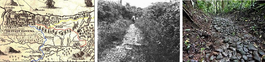
The second Venta de Cruces was a resting place for adventurers and conquerors who traveled this road for centuries; It was an important point on the Camino Real de Cruces, here the merchandise was unloaded and transferred to boats to be transported by the Chagres to the sea, or loaded on mule trains, if their destination was Panama.
With an area of 19,545 ha., located on the east bank of the Panama Canal, covering part of the province of Panama and Colón.
The park was created by Executive Decree No. 13 of May 27, 1980, and whose objective is the following:
a) Protect and conserve the natural and cultural values of the area.
b) Protect their genetic resources.
c) Develop Environmental Education and the opportunity for public recreation.
d) Provide opportunity for research and scientific activities at the end.
Article 5 of the Park establishes: the occupation of the area declared “Soberanía” national park and the development of agricultural activities, grazing, hunting, logging, burning, gathering and destruction of the renewable natural and cultural resources in it, as well as the commercials and signs. The Park is a natural area with easy land access from the cities of Panama and Colón.
Services: the administrative headquarters is located at the intersection of the Omar Torrijos highway (old Madden or Forestal), with the Gaillard highway, which is the one leading to the town of Gamboa, headquarters of the Dredging Directorate of the Panama Canal Authority.
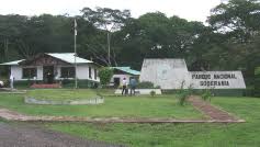
In the administrative headquarters we find the park offices, where the visitor is informed and oriented on issues related to it. We also find the houses of Technicians and Park Rangers that have all the basic services, used by the personnel who work in the park.
This protected area has 5 houses and control posts for the Park Rangers, located in: Unión Veragüense, Aguas Claras, Limón, Agua Salud and Frijoles.
Location: The park is located along the eastern bank of the Panama Canal, in the provinces of Panama and Colón and is 25 kilometers by road from Panama City.
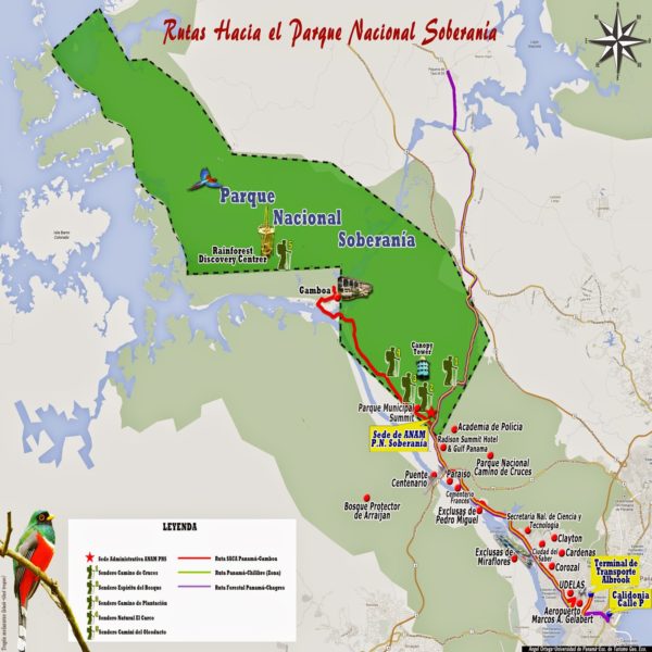
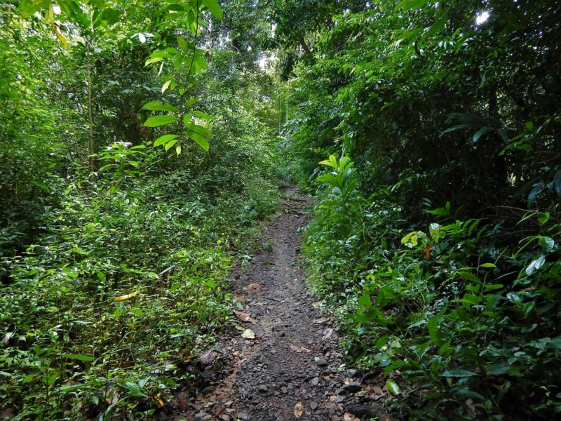
Access: It is one of the most easily accessible protected areas in the country since it is located just over half an hour from Panama City. A road leading to Madden Dam cuts through the park’s tropical rain forests.
Biodiversity
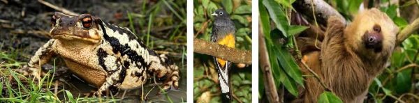
With 105 species of mammals, 525 species of birds, 79 of reptiles, 55 of amphibians and 36 species of freshwater fish, the park becomes an important wildlife refuge.
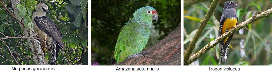
It is the birds that acquire the greatest role. On its best-known trail, the Pipeline Road, the Panama Audubon Society conducts an annual Christmas census. For 19 consecutive years it reached world records that culminated in 1996 when 525 species of birds were recorded in a single day. Among them, the presence of the endangered crested eagle (Morphnus guianensis), the spectacular red-fronted parrots (Amazona autumnalis) and different species of colorful trogons such as the purple trogon (Trogon violaceus) stand out. MOSI (Migratory Bird Monitoring) stations are also in operation by the Smithsonian Institute, which trained people from the San Antonio and Ella Puru communities in bird watching and data collection.
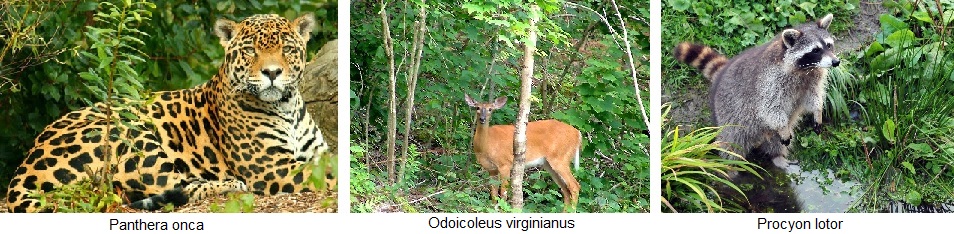
Among the mammals there is no lack of the presence of the jaguar (Panthera onca), white-tailed deer (Odoicoleus virginianus), ñeques (Dasyprocta punctata), raccoons (Procyon lotor) and herds of sainos (Tayassu tajacu).
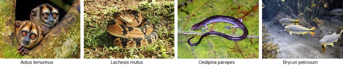
Various species of monkeys occupy the forest stratum, among them the small marmoset monkey (Saguinus oedipus) and the elusive jujaná (Aotus lemurinus). Reptiles such as the babillo (Caiman crocodylus) or the warty snake (Lachesis mutus), amphibians such as the common toad (Bufo marinus) or the salamander (Oedipina parvipes) and freshwater fish such as the pippon shad (Brycon petrosum) or the bearded ( Rhandia magnesi) are part of the vertebrate fauna of this protected area.
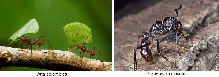
Invertebrates number in the thousands and it is easy to see the unmistakable nests and paths of the mule ants (Atta colombica) and to identify the dangerous folofa ant (Paraponera clavata).
Nature Trails
Soberania National Park has six nature trails where visitors can interact with the biological diversity of the tropical rainforest and enjoy the natural landscape of this protected area.
Pipeline Road

It is the best-known trail in the park. It has an area of 17 kilometers. In this place the Audubon Society of Panama annually conducts a bird census that reached a world record in 1996 when 525 species of birds were recorded in a single day. As early as 1976, the largest number of specimens recorded in a bird count per unit area had been recorded anywhere in the world.
Plantation Path
This trail has an area of 6.5 kilometers and is so named since in 1915 a banana and cocoa farm operated in this place, managed by the United States government.
El Charco Nature Trail
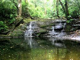
It is the shortest of the trails with an extension of 800 meters. It is located on Gaillard and on its way, it is possible to find pools of water where you can swim.
Camino Real de Cruces
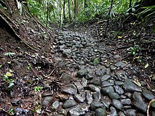
In its journey through the Soberania National Park, it has an approximate extension of 10.5 kilometers and is located between the ruins of the old town of Venta de Cruces, on the banks of the Chagres River, and the Madden highway. It is famous as it was the route used by the Spanish in the 16th century to transport merchandise and goods between the Pacific and Atlantic oceans.
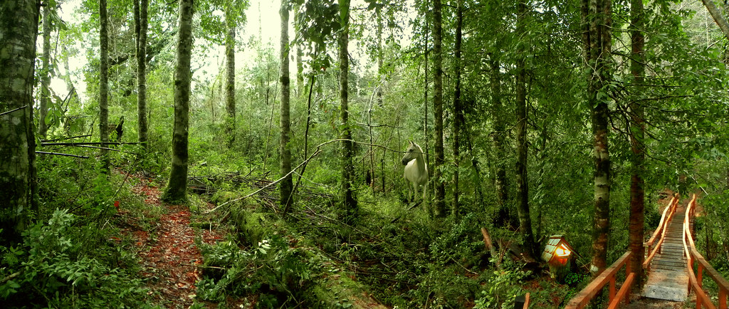
It is a self-guided trail with an extension of 1.7 kilometers. It has 13 interpretive stations with a painting or panel and a booth for its protection. For its layout, a multidisciplinary team was made up of personnel from the National Environmental Authority of Panama, the Ganexa University of Art and the support of the Colorado State University.5 And you can also find a lot of nature. During its tour it is possible to see white-faced monkeys, white-tailed deer, red squirrels, sloths and several species of birds.
Cycle-route
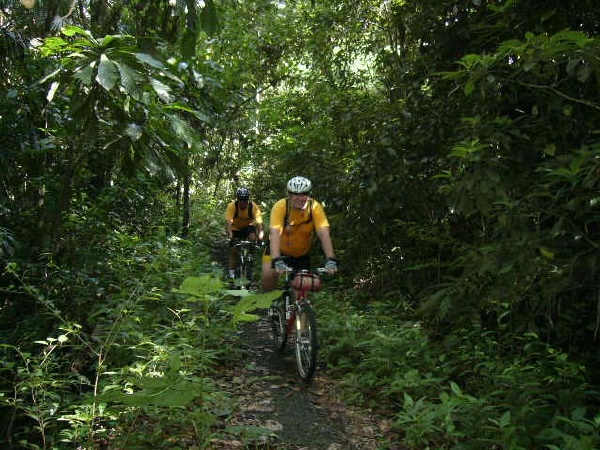
Special route dedicated to mountain biking. It has an area of 17.5 kilometers and crosses, in addition to the Soberania National Park, the Camino de Cruces National Park.